CONSTRUCTION SITE MONITORING
GEODIAG provides highly accurate and cost effective UAV Aerial Surveys, geospatial data acquisition and digital data processing services using advanced and innovative technologies. Digital photogrammetry methods make an inventory and monitoring of construction progress faster and better than traditional surveying techniques with an increased accuracy comparing to the requirements of existing legislation. Our robust service provides an accurate terrain dataset performed in a safe manner without operational downtime.
Spatial model of the former cloth factory Silesiana in Dzierżoniów, Poland. GEODIAG performer the preliminary site investigation service with drone aerial survey. Aerial material has been acquired and processed. Three-dimensional model was produced in order to identify a terrain feature.
3D model of plot located in the Źarów Special Economic Zone. The geotechnical investigation conducted by geodiag.pl in order to support planned infrastructure development projects.
CONSTRUCTION SITE MANAGEMENT
Elevation map of the backfill between foundation walls. The blue color shows the place where more concrete is needed.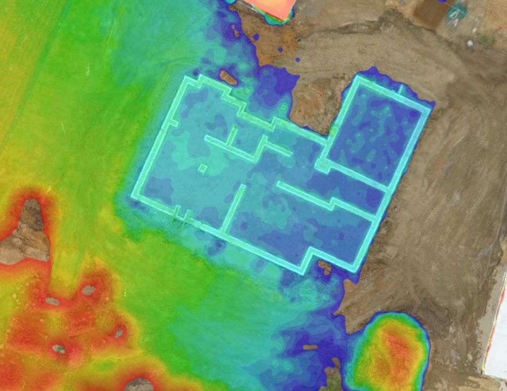
Photogrammetric data processing. Determining height of the foundation wall. Blue color represents lower elevation index.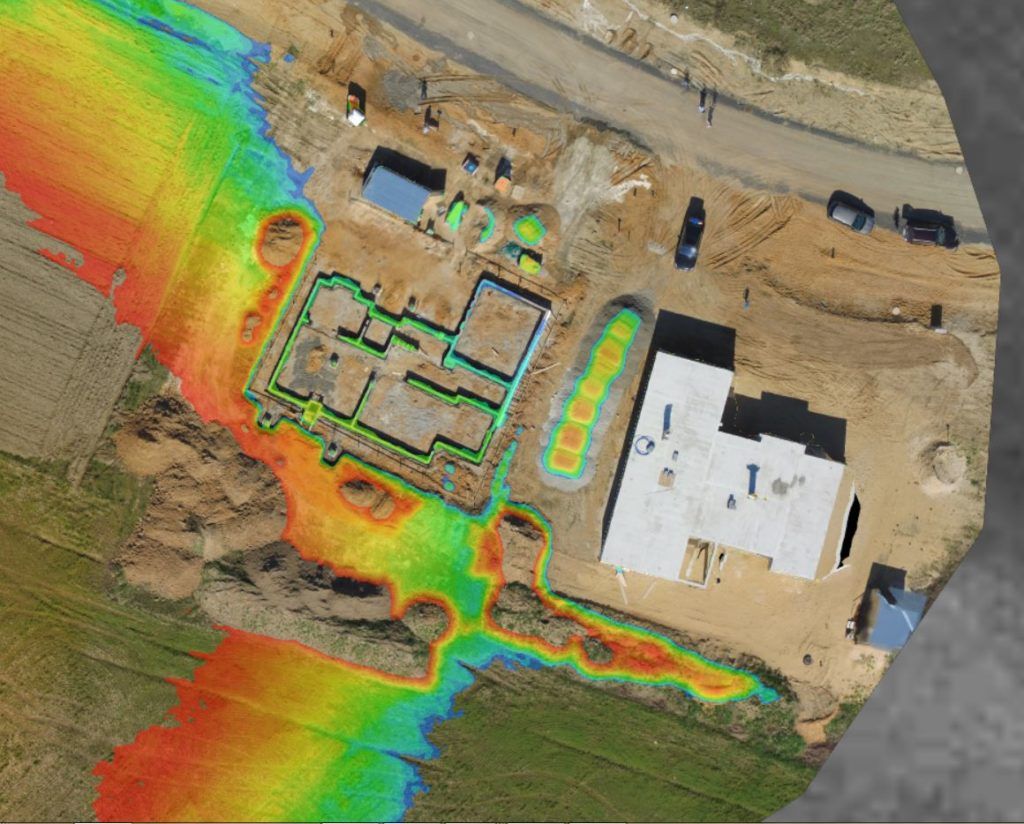
Stockpile volume calculation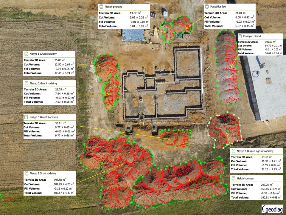
Monitoring of the excavation for foundation trench. Green color shows deeper trench 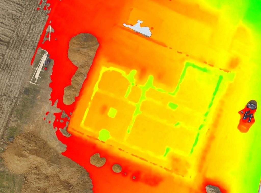
Earthworks construction planning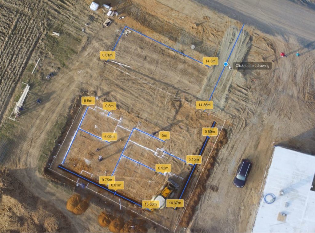
Call us now to find out more
Mob. + 48 605 052 752
Mob. + 48 500 383 284